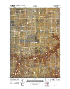
2011 Map of Klondike
USGS Topo · Published 2011About this map
Klondike serves as the focal point for this agricultural landscape in Sherman County, where the high plateau is incised by significant geographic depressions like Hay Canyon and Bull Canyon. The settlement pattern follows a grid of farm roads, including N Klondike Rd and Baseline Ln, which connect remote outposts such as Sandon and Webfoot.
Find a feature on this map
18 named features on this map. Tap any name to fly to it.
Don’t see what you’re looking for? This feature index may not catch every label — zoom into the map to look around manually.
Map Details
Editions of this 2011 Klondike Map
This is the sole edition of this map. No revisions or reprints were ever made.
Other maps of this area
1916 · Arlington
USGS Topo · 1:125,000
1916 · Condon
USGS Topo · 1:125,000
1953 · The Dalles
USGS Topo · 1:250,000
1956 · The Dalles
USGS Topo · 1:250,000
1957 · The Dalles
USGS Topo · 1:250,000
1957 · Wasco
USGS Topo · 1:62,500
1964 · Mc Donald
USGS Topo · 1:24,000
1970 · Esau Canyon
USGS Topo · 1:24,000
1971 · Moro
USGS Topo · 1:24,000
1971 · Quinton
USGS Topo · 1:24,000