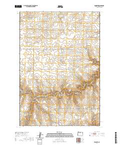
2020 Map of Klondike
USGS Topo · Published 2020About this map
Klondike serves as the focal point of this Sherman County landscape, situated where N Klondike Rd and the Old Wasco-Heppner Hwy intersect. The terrain is defined by a dense network of canyons and drainage systems, including Biglow Canyon to the north and the complex branching of Grass Valley Canyon and Hay Canyon to the south. Historically significant water sources like Emigrant Springs suggest the importance of this corridor for early travel and settlement in the dry interior of Oregon.
Find a feature on this map
32 named features on this map. Tap any name to fly to it.
Don’t see what you’re looking for? This feature index may not catch every label — zoom into the map to look around manually.
Map Details
Editions of this 2020 Klondike Map
This is the sole edition of this map. No revisions or reprints were ever made.
Other maps of this area
1916 · Arlington
USGS Topo · 1:125,000
1916 · Condon
USGS Topo · 1:125,000
1953 · The Dalles
USGS Topo · 1:250,000
1956 · The Dalles
USGS Topo · 1:250,000
1957 · The Dalles
USGS Topo · 1:250,000
1957 · Wasco
USGS Topo · 1:62,500
1964 · Mc Donald
USGS Topo · 1:24,000
1970 · Esau Canyon
USGS Topo · 1:24,000
1971 · Moro
USGS Topo · 1:24,000
1971 · Quinton
USGS Topo · 1:24,000