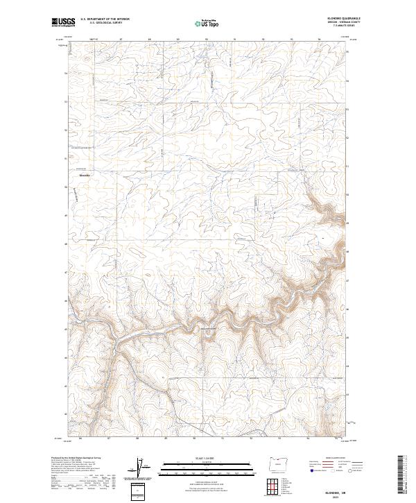
2023 Map of Klondike
USGS Topo · Published 2023About this map
Klondike serves as the focal point of this Sherman County survey, where the high wheat country of north-central Oregon meets a dramatic landscape of deeply incised drainages. The settlement is situated at the head of Spanish Hollow, a natural corridor that leads toward the Columbia River. The surrounding plateau is etched by significant topographical features such as Grass Valley Canyon, Emigrant Canyon, and Hay Canyon, reflecting the erosional power of seasonal water across the dry uplands.
Find a feature on this map
30 named features on this map. Tap any name to fly to it.
Don’t see what you’re looking for? This feature index may not catch every label — zoom into the map to look around manually.
Map Details
Editions of this 2023 Klondike Map
This is the sole edition of this map. No revisions or reprints were ever made.
Other maps of this area

1916 · Arlington
USGS Topo · 1:125,000

1916 · Condon
USGS Topo · 1:125,000

1953 · The Dalles
USGS Topo · 1:250,000

1956 · The Dalles
USGS Topo · 1:250,000

1957 · The Dalles
USGS Topo · 1:250,000

1957 · Wasco
USGS Topo · 1:62,500

1964 · Mc Donald
USGS Topo · 1:24,000
1970 · Esau Canyon
USGS Topo · 1:24,000

1971 · Moro
USGS Topo · 1:24,000

1971 · Quinton
USGS Topo · 1:24,000