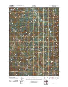
2011 Map of Kloster Mountain
USGS Topo · Published 2011About this map
Wildwood serves as a central point of interest in this drainage-rich portion of Lane County, where the topography is defined by the significant elevations of Kloster Mountain and Buckhorn Mountain. The landscape is a complex network of narrow creek valleys, including Gosage Creek and Guiley Creek, which feed into larger systems like Lost Creek. A clear history of local industry and access is evident in the naming of thoroughfares such as Old Gustina Mill Rd and Carr Trail Rd. For genealogists and researchers, the map provides precise locations for Noyas Pass and the winding course of McCauley Creek, illustrating the remote connectivity between these peaks and the small settlement at Wildwood. The presence of numerous secondary roads like Eagles Rest Rd suggests a landscape managed for forestry and recreation in the early twenty-first century.
Find a feature on this map
29 named features on this map. Tap any name to fly to it.
Don’t see what you’re looking for? This feature index may not catch every label — zoom into the map to look around manually.
Map Details
Editions of this 2011 Kloster Mountain Map
This is the sole edition of this map. No revisions or reprints were ever made.
Other maps of this area

1935 · Lowell
USGS Topo · 1:96,000

1942 · Lowell
USGS Topo · 1:125,000

1955 · Hardesty Mtn
USGS Topo · 1:62,500

1955 · Fairview Peak
USGS Topo · 1:62,500

1955 · Culp Creek
USGS Topo · 1:62,500

1955 · Lowell
USGS Topo · 1:62,500

1958 · Roseburg
USGS Topo · 1:250,000

1959 · Roseburg
USGS Topo · 1:250,000

1983 · Oakridge
USGS Topo · 1:100,000
1986 · Blue Mountain
USGS Topo · 1:24,000