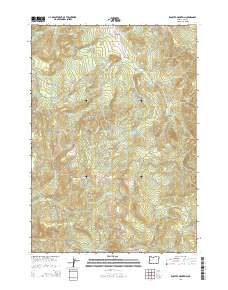
2014 Map of Kloster Mountain
USGS Topo · Published 2014About this map
Wildwood serves as a central reference point in this corner of Lane County, where the drainage systems of Teeter Cr and McCauley Cr meet. The landscape is defined by the steep elevation changes between Kloster Mountain in the north and Buckhorn Mtn to the south. Historically, the area's development is closely tied to timber and land management, as evidenced by naming conventions like the Old Giustina Mill Rd. A dense network of logging and resource roads, including June Mountain Rd and Carr Trail Rd, weaves through the drainages of Gosage Cr and Carr Cr. These corridors, alongside numerous Bureau of Land Management routes, illustrate the transition from early pioneer trails to modern industrial forest management. The presence of Noyas Pass further highlights the vital role of these mountain gaps in providing passage through the varied terrain.
Find a feature on this map
33 named features on this map. Tap any name to fly to it.
Don’t see what you’re looking for? This feature index may not catch every label — zoom into the map to look around manually.
Map Details
Editions of this 2014 Kloster Mountain Map
This is the sole edition of this map. No revisions or reprints were ever made.
Other maps of this area

1935 · Lowell
USGS Topo · 1:96,000

1942 · Lowell
USGS Topo · 1:125,000

1955 · Hardesty Mtn
USGS Topo · 1:62,500

1955 · Fairview Peak
USGS Topo · 1:62,500

1955 · Culp Creek
USGS Topo · 1:62,500

1955 · Lowell
USGS Topo · 1:62,500

1958 · Roseburg
USGS Topo · 1:250,000

1959 · Roseburg
USGS Topo · 1:250,000

1983 · Oakridge
USGS Topo · 1:100,000
1986 · Blue Mountain
USGS Topo · 1:24,000