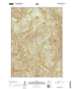
2020 Map of Kloster Mountain
USGS Topo · Published 2020About this map
Kloster Mtn and Buckhorn Mtn dominate this section of the Oregon Cascades in Lane County. The landscape is defined by a dense network of timber-access roads and drainage systems, reflecting the region's long-standing reliance on forestry. Notable among these is the Old Giustina Mill Rd, which hints at the historic industrial footprint of the Giustina family's lumber operations in the area. Numerous waterways, including Anthony Cr, Gosage Cr, and Teeter Cr, carve through the terrain, meeting at various elevations like Novas Pass. The map also shows smaller local routes such as Hartung Rd and June Mtn Rd, providing a detailed look at the rural infrastructure used for land management and recreation in the early twenty-first century.
Find a feature on this map
37 named features on this map. Tap any name to fly to it.
Don’t see what you’re looking for? This feature index may not catch every label — zoom into the map to look around manually.
Map Details
Editions of this 2020 Kloster Mountain Map
This is the sole edition of this map. No revisions or reprints were ever made.
Other maps of this area

1935 · Lowell
USGS Topo · 1:96,000

1942 · Lowell
USGS Topo · 1:125,000

1955 · Hardesty Mtn
USGS Topo · 1:62,500

1955 · Fairview Peak
USGS Topo · 1:62,500

1955 · Culp Creek
USGS Topo · 1:62,500

1955 · Lowell
USGS Topo · 1:62,500

1958 · Roseburg
USGS Topo · 1:250,000

1959 · Roseburg
USGS Topo · 1:250,000

1983 · Oakridge
USGS Topo · 1:100,000
1986 · Blue Mountain
USGS Topo · 1:24,000