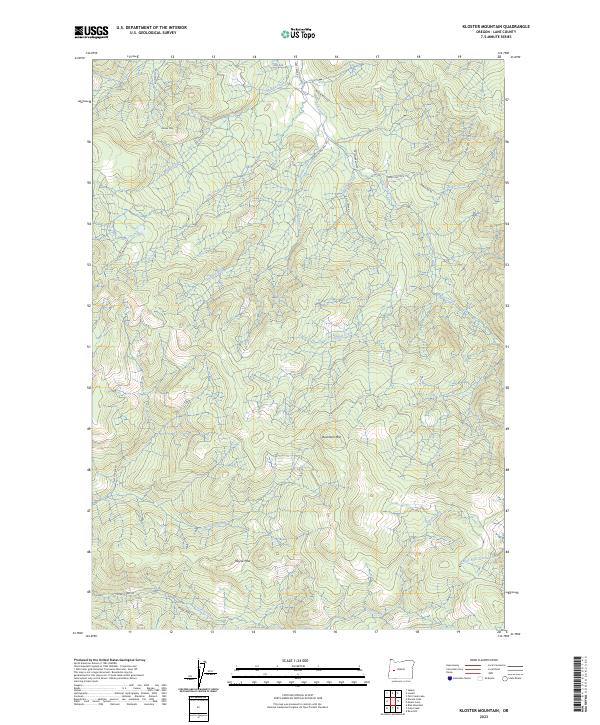
2023 Map of Kloster Mountain
USGS Topo · Published 2023About this map
Kloster Mtn and Buckhorn Mtn dominate this timber-rich section of Lane County, where the drainages of the Willamette watershed define the local geography. The presence of Old Giustina Mill Rd alludes to the region's industrial logging heritage, serving as a primary corridor through the steep terrain between Middle Creek and Lost Creek. This 2023 survey illustrates a landscape primarily managed for natural resources, evidenced by the extensive network of Bureau of Land Management roads like BLM Rd 20 1 11 and BLM Rd 19 1 35. From the high point of Noyas Pass in the south to the northern reaches of Apple Ln, the map details a complex web of named tributaries including East Gosage Creek, Gulley Creek, and the West Fork Junetta Creek, providing essential data for modern hydrologic and topographic study.
Find a feature on this map
34 named features on this map. Tap any name to fly to it.
Don’t see what you’re looking for? This feature index may not catch every label — zoom into the map to look around manually.
Map Details
Editions of this 2023 Kloster Mountain Map
This is the sole edition of this map. No revisions or reprints were ever made.
Other maps of this area

1935 · Lowell
USGS Topo · 1:96,000

1942 · Lowell
USGS Topo · 1:125,000

1955 · Hardesty Mtn
USGS Topo · 1:62,500

1955 · Fairview Peak
USGS Topo · 1:62,500

1955 · Culp Creek
USGS Topo · 1:62,500

1955 · Lowell
USGS Topo · 1:62,500

1958 · Roseburg
USGS Topo · 1:250,000

1959 · Roseburg
USGS Topo · 1:250,000

1983 · Oakridge
USGS Topo · 1:100,000
1986 · Blue Mountain
USGS Topo · 1:24,000