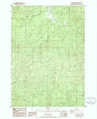
1986 Map of Kloster Mtn
USGS Topo · Published 1986About this map
Kloster Mtn and Buckhorn Mtn dominate this mid-1980s landscape in Lane County, Oregon, where the rugged topography is defined by an intricate network of drainage systems. The map details a transition from the higher peaks into the valleys formed by Lost Creek, Gosage Creek, and Teeter Creek. This period of land use is characterized by a heavy industrial presence, evidenced by numerous Quarry sites scattered across the mountain flanks, linked by a complex system of logging roads and private ways like Anthony Private. A notable geographic feature, Noyas Pass, provides a point of transit between the southern drainages. The sheer density of small watercourses, including Guiley Creek and East Gosage Creek, illustrates the hydrological complexity of the western Cascades foothills before modern reforestation and changing land management altered the visibility of these industrial access routes.
Find a feature on this map
19 named features on this map. Tap any name to fly to it.
Don’t see what you’re looking for? This feature index may not catch every label — zoom into the map to look around manually.
Map Details
Editions of this 1986 Kloster Mtn Map
This is the sole edition of this map. No revisions or reprints were ever made.
Other maps of this area

1935 · Lowell
USGS Topo · 1:96,000

1942 · Lowell
USGS Topo · 1:125,000

1955 · Hardesty Mtn
USGS Topo · 1:62,500

1955 · Fairview Peak
USGS Topo · 1:62,500

1955 · Culp Creek
USGS Topo · 1:62,500

1955 · Lowell
USGS Topo · 1:62,500

1958 · Roseburg
USGS Topo · 1:250,000

1959 · Roseburg
USGS Topo · 1:250,000

1983 · Oakridge
USGS Topo · 1:100,000
1986 · Blue Mountain
USGS Topo · 1:24,000