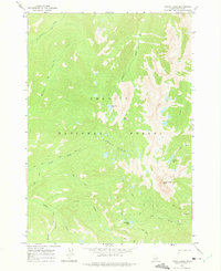
1964 Map of Knapp Lakes
USGS Topo · Published 1975About this map
The high backcountry of Challis National Forest is defined here by a network of drainage systems and high alpine water bodies, including Horseshoe Lake and Fish Lake. The area reflects a mid-century landscape accessible primarily by primitive routes, with the Winnemucca Pack Trail and various other pack trails serving as the primary infrastructure for movement through the steep terrain.
Find a feature on this map
21 named features on this map. Tap any name to fly to it.
Don’t see what you’re looking for? This feature index may not catch every label — zoom into the map to look around manually.
Map Details
Editions of this 1964 Knapp Lakes Map
3 editions found
Other maps of this area

1891 · Bear Valley
USGS Topo · 1:125,000

1893 · Bear Valley
USGS Topo · 1:125,000

1919 · Custer
USGS Topo · 1:125,000

1922 · Custer
USGS Topo · 1:125,000

1930 · Casto
USGS Topo · 1:125,000

1957 · Challis
USGS Topo · 1:250,000

1960 · Challis
USGS Topo · 1:250,000

1961 · Greyhound Ridge
USGS Topo · 1:62,500

1963 · Challis
USGS Topo · 1:250,000

1963 · Pinyon Peak
USGS Topo · 1:24,000