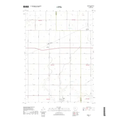
2018 Map of Knierim
USGS Topo · Published 2018About this map
Knierim and Somers serve as the primary hubs of this agricultural landscape along the border of Calhoun and Webster Counties. The map illustrates a highly organized grid of rural roads, including Xenia Ave, York Ave, and Baxter Ave, that weave between the drainage systems of the Iowa plains. For genealogists and local historians, several landmarks are clearly noted, such as Trinity Cem, Greenfield Township Cem, and the Calvary United Presbyterian Cem near the eastern edge. Water management is a defining characteristic of this terrain, evidenced by features like Welshs Slough, Ditch Number 31, and the meandering paths of E Cedar Cr and W Cedar Cr. In the southern portion of the sheet, the town of Somers is shown with its street-level detail, including Welsh Bridge and several numbered avenues, providing a clear record of the community's footprint in the late 2010s.
Find a feature on this map
46 named features on this map. Tap any name to fly to it.
Don’t see what you’re looking for? This feature index may not catch every label — zoom into the map to look around manually.
Map Details
Editions of this 2018 Knierim Map
This is the sole edition of this map. No revisions or reprints were ever made.
Other maps of this area

1954 · Fort Dodge
USGS Topo · 1:250,000

1957 · Fort Dodge
USGS Topo · 1:250,000

1958 · Fort Dodge
USGS Topo · 1:250,000

1965 · Moorland
USGS Topo · 1:24,000

1965 · Farnhamville
USGS Topo · 1:24,000

1965 · Knierim
USGS Topo · 1:24,000

1965 · Gowrie
USGS Topo · 1:24,000

1979 · Clare
USGS Topo · 1:24,000

1979 · Gilmore City SW
USGS Topo · 1:24,000

1979 · Manson
USGS Topo · 1:24,000