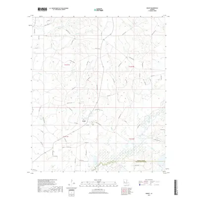
2018 Map of Knight
USGS Topo · Published 2018About this map
Knight and its surrounding timberlands and creek bottoms are documented here in western Louisiana near the Vernon Parish and Beauregard Parish line. This landscape is defined by an intricate network of waterways, including Bayou Anacoco and Pocosin Cr, which carve through the piney woods. Local history is anchored at the Hinson Cem and along a web of family-named roads such as Burrell Harvey Rd and Lynn Davis Rd. The drainage patterns are particularly clear, showing the numerous small branches like Permidia Br, Damrel Cr, and Moore Br that feed into larger basins. This map reflects a rural environment where land use is tied closely to the natural topography of the gulf coastal plain, with many roads specifically serving the local creek valleys and ridges.
Find a feature on this map
70 named features on this map. Tap any name to fly to it.
Don’t see what you’re looking for? This feature index may not catch every label — zoom into the map to look around manually.
Map Details
Editions of this 2018 Knight Map
This is the sole edition of this map. No revisions or reprints were ever made.
Other maps of this area

1941 · Leesville
USGS Topo · 1:62,500

1943 · Leesville
USGS Topo · 1:62,500

1944 · Wiergate
USGS Topo · 1:62,500

1946 · Leesville
USGS Topo · 1:62,500

1946 · Merryville
USGS Topo · 1:31,680

1947 · Pujo
USGS Topo · 1:31,680

1947 · DeRidder
USGS Topo · 1:31,680

1947 · Rosepine
USGS Topo · 1:31,680

1947 · Knight
USGS Topo · 1:31,680

1948 · Leesville
USGS Topo · 1:62,500