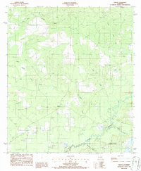
1986 Map of Knight
USGS Topo · Published 1986About this map
Knight and Fal anchor this 1980s landscape at the boundary of Vernon Parish and Beauregard Parish. The terrain is defined by a dense network of drainage, where Bayou Anacoco flows through the southern section, joined by Brockston Gully and Cypress Creek. To the north, the hydrology is shaped by Red Bank Creek and its tributary Permidia Branch, alongside the winding paths of Damrel Creek and Pocosin Creek.
Find a feature on this map
18 named features on this map. Tap any name to fly to it.
Don’t see what you’re looking for? This feature index may not catch every label — zoom into the map to look around manually.
Map Details
Editions of this 1986 Knight Map
This is the sole edition of this map. No revisions or reprints were ever made.
Other maps of this area

1941 · Leesville
USGS Topo · 1:62,500

1943 · Leesville
USGS Topo · 1:62,500

1944 · Wiergate
USGS Topo · 1:62,500

1946 · Leesville
USGS Topo · 1:62,500

1946 · Merryville
USGS Topo · 1:31,680

1947 · Pujo
USGS Topo · 1:31,680

1947 · DeRidder
USGS Topo · 1:31,680

1947 · Rosepine
USGS Topo · 1:31,680

1947 · Knight
USGS Topo · 1:31,680

1948 · Leesville
USGS Topo · 1:62,500