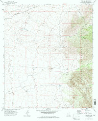
1973 Map of Knob Hill
USGS Topo · Published 1976About this map
Dragoon Mountains dominate the eastern landscape of this Cochise County quadrangle, where the Coronado National Forest boundary meets the high desert floor. The topography is defined by significant landmarks such as Knob Hill and the archaeological interest of Council Rocks. Historical land use is evident in the northern sections, where the Southern Pacific railroad runs through Tully alongside early industrial features like a Quarry and various Pipelines.
Find a feature on this map
32 named features on this map. Tap any name to fly to it.
Don’t see what you’re looking for? This feature index may not catch every label — zoom into the map to look around manually.
Map Details
Editions of this 1973 Knob Hill Map
2 editions found
Other maps of this area

1915 · Benson
USGS Topo · 1:125,000

1916 · Pearce
USGS Topo · 1:125,000

1922 · Willcox
USGS Topo · 1:125,000

1922 · St. David
USGS Topo · 1:62,500

1926 · Courtland
USGS Topo · 1:62,500

1943 · Benson
USGS Topo · 1:125,000

1943 · Cochise
USGS Topo · 1:62,500

1943 · Dragoon
USGS Topo · 1:62,500

1954 · Silver City
USGS Topo · 1:250,000

1955 · Douglas
USGS Topo · 1:250,000