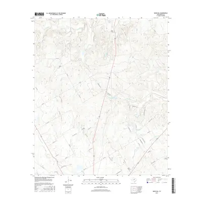
2016 Map of Knob Hill
USGS Topo · Published 2016About this map
N Paluxy River and S Paluxy River drain this portion of Erath County, where the landscape is defined by the divides between the Paluxy and the N Fork N Bosque River. Small reservoirs such as Collier Lake and Stephenville Country Club Lake are integrated into the drainage network of Henshaw Cr and other local tributaries. The map shows a rural settlement pattern evolving toward modern residential developments like Hill Valley Ests.
Find a feature on this map
62 named features on this map. Tap any name to fly to it.
Don’t see what you’re looking for? This feature index may not catch every label — zoom into the map to look around manually.
Map Details
Editions of this 2016 Knob Hill Map
This is the sole edition of this map. No revisions or reprints were ever made.
Other maps of this area

1890 · Stephenville
USGS Topo · 1:125,000

1920 · Stephenville
USGS Topo · 1:125,000

1954 · Abilene
USGS Topo · 1:250,000

1958 · Abilene
USGS Topo · 1:250,000

1961 · Johnsville
USGS Topo · 1:24,000

1961 · Knob Hill
USGS Topo · 1:24,000

1961 · Stephenville
USGS Topo · 1:24,000
1965 · Bluff Dale NE
USGS Topo · 1:24,000
1965 · Bunyan
USGS Topo · 1:24,000
1965 · Huckabay
USGS Topo · 1:24,000