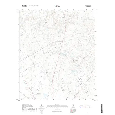
2019 Map of Knob Hill
USGS Topo · Published 2019About this map
Stephenville Country Club Lake sits at the heart of this North Texas landscape, where the headwaters of the N Paluxy River and S Paluxy River converge. This 2019 survey documents a rural transition zone in Erath County, marked by the emergence of residential pockets like Hill Valley Ests among long-established ranching and agricultural tracts. The terrain is defined by its drainage patterns, with numerous small waterways such as Rough Cr and Indian Camp Cr carving through the elevation.
Find a feature on this map
62 named features on this map. Tap any name to fly to it.
Don’t see what you’re looking for? This feature index may not catch every label — zoom into the map to look around manually.
Map Details
Editions of this 2019 Knob Hill Map
This is the sole edition of this map. No revisions or reprints were ever made.
Other maps of this area

1890 · Stephenville
USGS Topo · 1:125,000

1920 · Stephenville
USGS Topo · 1:125,000

1954 · Abilene
USGS Topo · 1:250,000

1958 · Abilene
USGS Topo · 1:250,000

1961 · Johnsville
USGS Topo · 1:24,000

1961 · Knob Hill
USGS Topo · 1:24,000

1961 · Stephenville
USGS Topo · 1:24,000
1965 · Bluff Dale NE
USGS Topo · 1:24,000
1965 · Bunyan
USGS Topo · 1:24,000
1965 · Huckabay
USGS Topo · 1:24,000