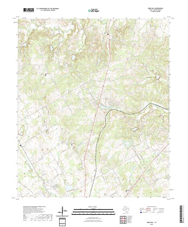
2022 Map of Knob Hill
USGS Topo · Published 2022About this map
N Paluxy River and its many tributaries, including Rough Cr and Straight Cr, define the drainage patterns across this Erath County landscape. The area is characterized by a high concentration of small, family-style burial grounds such as Morton Chapel Cem, Bethel Cem, and Oak Dale Cem, which often represent the last visible remnants of early rural communities. Towards the south, the watershed shifts toward the N Fork N Bosque River. Modern land use and water management are evident in several reservoirs, notably Stephenville Country Club Lake, Terrell Lake, and the twin basins of Bonham Lake Number 1 and Bonham Lake Number 2. Small residential developments like Hill Valley Ests appear amidst an extensive network of county roads.
Find a feature on this map
58 named features on this map. Tap any name to fly to it.
Don’t see what you’re looking for? This feature index may not catch every label — zoom into the map to look around manually.
Map Details
Editions of this 2022 Knob Hill Map
This is the sole edition of this map. No revisions or reprints were ever made.
Other maps of this area

1890 · Stephenville
USGS Topo · 1:125,000

1920 · Stephenville
USGS Topo · 1:125,000

1954 · Abilene
USGS Topo · 1:250,000

1958 · Abilene
USGS Topo · 1:250,000

1961 · Johnsville
USGS Topo · 1:24,000

1961 · Knob Hill
USGS Topo · 1:24,000

1961 · Stephenville
USGS Topo · 1:24,000
1965 · Bluff Dale NE
USGS Topo · 1:24,000
1965 · Bunyan
USGS Topo · 1:24,000
1965 · Huckabay
USGS Topo · 1:24,000