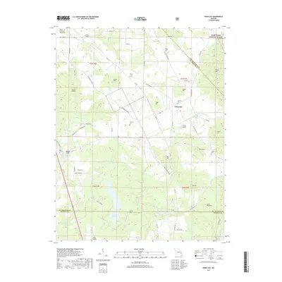
2017 Map of Knob Lick
USGS Topo · Published 2017About this map
The Little Saint Francis River cuts a central path through this section of the Ozark Plateau, where the rugged terrain of the Saint Francois Mountains transitions into the productive valley lands of Libertyville and Knob Lick. The landscape is a mosaic of family-named hollows and knobs, such as Gobble Hollow and Peg Knob, reflecting a long history of rural land use and timber management within the Mark Twain National Forest. Local heritage is anchored by a significant number of small burial grounds, including the Harris Cem, Sebastian Cem, and Methodist Cem, which are scattered among the ridges and along historic thoroughfares like Old Fredericktown Rd. The southern portion of the quadrangle shows the headwaters of Rock Cr and the waters of Lake La Motte, where the Saint Francois and Madison county lines meet near Castle Rock.
Find a feature on this map
77 named features on this map. Tap any name to fly to it.
Don’t see what you’re looking for? This feature index may not catch every label — zoom into the map to look around manually.
Map Details
Editions of this 2017 Knob Lick Map
This is the sole edition of this map. No revisions or reprints were ever made.
Other maps of this area

1904 · Farmington
USGS Topo · 1:62,500

1906 · Farmington
USGS Topo · 1:62,500

1907 · Weingarten
USGS Topo · 1:62,500

1909 · Weingarten
USGS Topo · 1:62,500

1910 · Higdon
USGS Topo · 1:62,500

1939 · Fredericktown
USGS Topo · 1:48,000

1947 · Fredericktown
USGS Topo · 1:62,500

1949 · Rolla
USGS Topo · 1:250,000

1950 · Fredericktown
USGS Topo · 1:62,500

1953 · Rolla
USGS Topo · 1:250,000