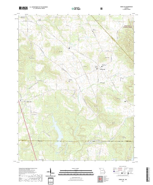
2021 Map of Knob Lick
USGS Topo · Published 2021About this map
The Saint Francois Mountains anchor the landscape of this southern St. Francois County region, where the town of Libertyville serves as a central hub of local history and heritage. Three distinct burial grounds—the Libertyville Christian Church Cem, Libertyville Methodist Cem, and the Wesley Chapel Cem—lie clustered near the settlement, reflecting the community's deep-rooted congregational history. Further southwest, the village of Knob Lick sits along the road network near its namesake Knob Lick Cem.
Find a feature on this map
75 named features on this map. Tap any name to fly to it.
Don’t see what you’re looking for? This feature index may not catch every label — zoom into the map to look around manually.
Map Details
Editions of this 2021 Knob Lick Map
This is the sole edition of this map. No revisions or reprints were ever made.
Other maps of this area

1904 · Farmington
USGS Topo · 1:62,500

1906 · Farmington
USGS Topo · 1:62,500

1907 · Weingarten
USGS Topo · 1:62,500

1909 · Weingarten
USGS Topo · 1:62,500

1910 · Higdon
USGS Topo · 1:62,500

1939 · Fredericktown
USGS Topo · 1:48,000

1947 · Fredericktown
USGS Topo · 1:62,500

1949 · Rolla
USGS Topo · 1:250,000

1950 · Fredericktown
USGS Topo · 1:62,500

1953 · Rolla
USGS Topo · 1:250,000