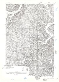
1935 Map of Knobby Creek
USGS Topo · Published 1935About this map
Lake of the Ozarks dominates the northern and eastern reaches of this mid-1930s landscape, its irregular shoreline cutting into the dissected hills of the Camden and Morgan County border. The topography is defined by narrow ridges and deep drainages like Wayne Hollow and Strawberry Hollow, which create a complex network of natural corridors. Small rural settlements and gathering points are scattered throughout the interior, notably at Lively and Sagrada, alongside seasonal sites like Knobby Creek Camp.
Find a feature on this map
24 named features on this map. Tap any name to fly to it.
Don’t see what you’re looking for? This feature index may not catch every label — zoom into the map to look around manually.
Map Details
Editions of this 1935 Knobby Creek Map
2 editions found

Other maps of this area

1887 · Warsaw
USGS Topo · 1:125,000

1888 · Versailles
USGS Topo · 1:125,000

1893 · Versailles
USGS Topo · 1:125,000

1894 · Warsaw
USGS Topo · 1:125,000

1904 · Gravois Mills
USGS Topo · 1:62,500

1934 · Irontown Ferry
USGS Topo · 1:24,000

1935 · Barnumton
USGS Topo · 1:24,000

1935 · Proctor Creek
USGS Topo · 1:24,000

1935 · Edwards
USGS Topo · 1:24,000

1935 · Boylers Mill
USGS Topo · 1:24,000