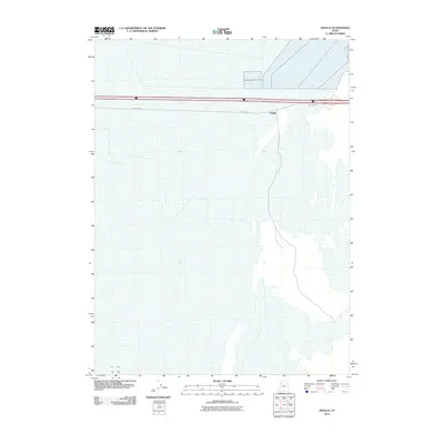
2010 Map of Knolls
USGS Topo · Published 2010About this map
Knolls is the primary geographic focus in this section of Tooele County, Utah, situated within a vast expanse of salt flats and playa. This 2010 USGS study highlights the infrastructure of the area, notably the corridor dominated by Frontage Rd which runs parallel to the primary transportation artery. The landscape is characterized by its extreme flatness and sparse development, with the small settlement of Knolls serving as a rare point of reference amidst the salt-crusted terrain of the Great Salt Lake Desert. The map detail reflects the region's role as a transit waypoint and an area defined by saline geography rather than dense human settlement.
Find a feature on this map
2 named features on this map. Tap any name to fly to it.
Don’t see what you’re looking for? This feature index may not catch every label — zoom into the map to look around manually.
Map Details
Editions of this 2010 Knolls Map
This is the sole edition of this map. No revisions or reprints were ever made.
Other maps of this area

1953 · Tooele
USGS Topo · 1:250,000

1955 · Tooele
USGS Topo · 1:250,000

1973 · Knolls SW
USGS Topo · 1:24,000

1973 · Knolls
USGS Topo · 1:24,000

1973 · Aragonite NW
USGS Topo · 1:24,000

1973 · Barro
USGS Topo · 1:24,000

1973 · Knolls SE
USGS Topo · 1:24,000

1973 · Grayback Hills
USGS Topo · 1:24,000

1973 · Aragonite SW
USGS Topo · 1:24,000

1973 · Knolls 2 SW
USGS Topo · 1:24,000