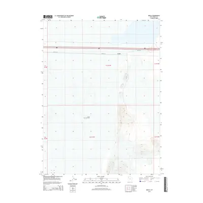
2014 Map of Knolls
USGS Topo · Published 2014About this map
Great Salt Lake Desert dominates this arid landscape, showing the stark salt flats and minimal terrain variations of the Tooele County interior. The small settlement of Knolls serves as the primary waypoint in this expanse, positioned alongside the critical transportation corridor of Interstate 80 and its associated Frontage Rd. The map illustrates the geometric precision of the Public Land Survey System, with township and range lines like t1s r13w and t2s r13w dividing the basin. This survey provides a technical look at how infrastructure traverses one of the most famously desolate environments in the United States, where the high-speed transit of the interstate contrasts with the vast, open silence of the salt flats.
Find a feature on this map
11 named features on this map. Tap any name to fly to it.
Don’t see what you’re looking for? This feature index may not catch every label — zoom into the map to look around manually.
Map Details
Editions of this 2014 Knolls Map
This is the sole edition of this map. No revisions or reprints were ever made.
Other maps of this area

1953 · Tooele
USGS Topo · 1:250,000

1955 · Tooele
USGS Topo · 1:250,000

1973 · Knolls SW
USGS Topo · 1:24,000

1973 · Knolls
USGS Topo · 1:24,000

1973 · Aragonite NW
USGS Topo · 1:24,000

1973 · Barro
USGS Topo · 1:24,000

1973 · Knolls SE
USGS Topo · 1:24,000

1973 · Grayback Hills
USGS Topo · 1:24,000

1973 · Aragonite SW
USGS Topo · 1:24,000

1973 · Knolls 2 SW
USGS Topo · 1:24,000