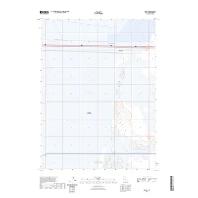
2023 Map of Knolls
USGS Topo · Published 2023About this map
Great Salt Lake Desert dominates the landscape of this region, where salt flats and alkaline plains reach toward the horizon. The settlement of Knolls serves as a lone point of reference along the primary transportation corridor that bisects the northern half of the map. To the south, the boundary of the Utah Test and Training Range indicates the vast military presence that characterizes much of the West Desert. This modern survey illustrates the essential infrastructure required to navigate this environment, including the Floating Island Dike Rd, which cuts across the basin floor. The map provides a precise look at the drainage patterns and subtle topographic rises that define the interior of one of the nation's most distinctive and isolated terrains.
Find a feature on this map
4 named features on this map. Tap any name to fly to it.
Don’t see what you’re looking for? This feature index may not catch every label — zoom into the map to look around manually.
Map Details
Editions of this 2023 Knolls Map
This is the sole edition of this map. No revisions or reprints were ever made.
Other maps of this area

1953 · Tooele
USGS Topo · 1:250,000

1955 · Tooele
USGS Topo · 1:250,000

1973 · Knolls SW
USGS Topo · 1:24,000

1973 · Knolls
USGS Topo · 1:24,000

1973 · Aragonite NW
USGS Topo · 1:24,000

1973 · Barro
USGS Topo · 1:24,000

1973 · Knolls SE
USGS Topo · 1:24,000

1973 · Grayback Hills
USGS Topo · 1:24,000

1973 · Aragonite SW
USGS Topo · 1:24,000

1973 · Knolls 2 SW
USGS Topo · 1:24,000