
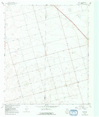
1966 Map of Knott
USGS Topo · Published 1968About this map
The semi-arid plains of West Texas are meticulously documented in this mid-1960s study of the Martin Co Howard Co line. Centered on the settlement of Knott, the map reveals a landscape heavily shaped by petroleum extraction and early agricultural infrastructure. Scattered Oil Wells, Drill Holes, and various pipelines indicate the industrial footprint of the Permian Basin during this era, while the small community of Brown and several isolated wells mark the sparse habitation of the region. The map provides a clear look at the intersection of county boundaries and the linear patterns of land surveying that define this part of the Llano Estacado. A single Gravel Pit and a remote Substation further illustrate the specialized land use required to support the local energy and ranching economies.
Find a feature on this map
11 named features on this map. Tap any name to fly to it.
Don’t see what you’re looking for? This feature index may not catch every label — zoom into the map to look around manually.
Map Details
Editions of this 1966 Knott Map
2 editions found
Other maps of this area

1954 · Big Spring
USGS Topo · 1:250,000

1958 · Big Spring
USGS Topo · 1:250,000

1966 · Merrick
USGS Topo · 1:24,000

1966 · Knott SE
USGS Topo · 1:24,000

1966 · Knott SW
USGS Topo · 1:24,000
1966 · Lenorah East
USGS Topo · 1:24,000

1966 · Knott NE
USGS Topo · 1:24,000

1970 · Vealmoor
USGS Topo · 1:24,000

1970 · Ackerly
USGS Topo · 1:24,000
1970 · Sparenberg
USGS Topo · 1:24,000