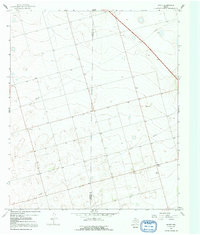
1966 Map of Knott
USGS Topo · Published 1991About this map
Knott serves as the primary hub of this West Texas landscape during the mid-1960s, situated at the boundary of Martin Co and Howard Co. The area is characterized by the infrastructure of the energy industry, with numerous Oil Well sites and Drill Holes scattered across the terrain, linked by an extensive Pipeline network and a local Substation.
Find a feature on this map
11 named features on this map. Tap any name to fly to it.
Don’t see what you’re looking for? This feature index may not catch every label — zoom into the map to look around manually.
Map Details
Editions of this 1966 Knott Map
2 editions found
Other maps of this area

1954 · Big Spring
USGS Topo · 1:250,000

1958 · Big Spring
USGS Topo · 1:250,000

1966 · Knott
USGS Topo · 1:24,000

1966 · Merrick
USGS Topo · 1:24,000

1966 · Knott SE
USGS Topo · 1:24,000

1966 · Knott SW
USGS Topo · 1:24,000
1966 · Lenorah East
USGS Topo · 1:24,000

1966 · Knott NE
USGS Topo · 1:24,000

1970 · Vealmoor
USGS Topo · 1:24,000

1970 · Ackerly
USGS Topo · 1:24,000