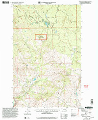
2001 Map of Knowlton Knob
USGS Topo · Published 2004About this map
Knowlton Knob Lookout stands as a central vantage point over this rugged portion of the Okanogan National Forest at the turn of the 21st century. The landscape is defined by significant elevations such as Mount Leecher and Buckhorn Mountain, while drainage systems like French Creek and Swamp Creek carve through the high country. Historical industry is evidenced by the Gambles Mill (Site), marking the site of early timber or agricultural processing near Paradise Spring. To the south, the Indian Dan State Wildlife Area highlights a shift toward conservation and habitat management. Numerous water sources, including Russian Spring, Bock Spring, and Secret Lake, are mapped alongside practical range features like a Corral and Stock Tank, illustrating the dual use of these public lands for both resource extraction and wildlife preservation.
Find a feature on this map
22 named features on this map. Tap any name to fly to it.
Don’t see what you’re looking for? This feature index may not catch every label — zoom into the map to look around manually.
Map Details
Editions of this 2001 Knowlton Knob Map
This is the sole edition of this map. No revisions or reprints were ever made.
Other maps of this area

1899 · Methow
USGS Topo · 1:125,000

1901 · Methow
USGS Topo · 1:125,000

1905 · Okanogan
USGS Topo · 1:125,000

1954 · Okanogan
USGS Topo · 1:250,000

1955 · Concrete
USGS Topo · 1:250,000

1956 · Loup Loup
USGS Topo · 1:62,500

1957 · Brewster
USGS Topo · 1:62,500

1958 · Concrete
USGS Topo · 1:250,000

1958 · Okanogan
USGS Topo · 1:250,000

1962 · Concrete
USGS Topo · 1:250,000