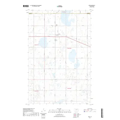
2017 Map of Knox
USGS Topo · Published 2017About this map
Knox serves as the central hub of this prairie landscape along the border of Pierce and Benson Counties. The town's layout is clearly defined by local thoroughfares such as Morgan St and Knox Rd, reflecting the grid-based settlement typical of North Dakota’s agricultural heartland. The surrounding terrain is characterized by a dense network of wetlands and small water bodies that punctuate the plains, particularly concentrated in township t156n r70w. Several local burial grounds, including the Knox Lutheran Cem, Knox Cem, and Saint Marys Cem, offer significant reference points for genealogists and local historians tracking family histories in this rural community. The map also delineates a systematic network of section roads, including 64th St NE and 43rd Ave NE, which historically facilitated the movement of goods and people across the region.
Find a feature on this map
29 named features on this map. Tap any name to fly to it.
Don’t see what you’re looking for? This feature index may not catch every label — zoom into the map to look around manually.
Map Details
Editions of this 2017 Knox Map
This is the sole edition of this map. No revisions or reprints were ever made.
Other maps of this area

1953 · Devils Lake
USGS Topo · 1:250,000

1956 · Devils Lake
USGS Topo · 1:250,000

1958 · Fillmore
USGS Topo · 1:24,000

1958 · Baker
USGS Topo · 1:24,000

1958 · Harlow
USGS Topo · 1:24,000

1971 · Wolford
USGS Topo · 1:24,000

1971 · Knox
USGS Topo · 1:24,000

1971 · Rugby NE
USGS Topo · 1:24,000

1971 · Hurricane Lake West
USGS Topo · 1:24,000

1971 · York
USGS Topo · 1:24,000