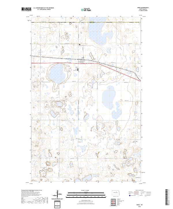
2024 Map of Knox
USGS Topo · Published 2024About this map
Knox serves as the central hub of this prairie landscape, where the grain-growing heritage of the North Dakota plains meets a complex network of glacial wetlands. The town's local history is anchored by several burial grounds including Knox Lutheran Cem, Saint Marys Cem, and Knox Cem, while Pleasant Valley Cem lies further to the southeast. The survey reveals a significant commitment to conservation, with the Benson County Waterfowl Production Area encompassing numerous parcels of land designed to preserve the region's vital migratory bird habitat. This pattern of land use highlights the coexistence of agriculture and ecological preservation in the Drift Prairie, where sections are divided by a precise grid of rural routes such as 66th St NE and Knox Rd crossing the county line between Pierce and Benson.
Find a feature on this map
27 named features on this map. Tap any name to fly to it.
Don’t see what you’re looking for? This feature index may not catch every label — zoom into the map to look around manually.
Map Details
Editions of this 2024 Knox Map
This is the sole edition of this map. No revisions or reprints were ever made.
Other maps of this area

1953 · Devils Lake
USGS Topo · 1:250,000

1956 · Devils Lake
USGS Topo · 1:250,000

1958 · Fillmore
USGS Topo · 1:24,000

1958 · Baker
USGS Topo · 1:24,000

1958 · Harlow
USGS Topo · 1:24,000

1971 · Wolford
USGS Topo · 1:24,000

1971 · Knox
USGS Topo · 1:24,000

1971 · Rugby NE
USGS Topo · 1:24,000

1971 · Hurricane Lake West
USGS Topo · 1:24,000

1971 · York
USGS Topo · 1:24,000