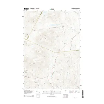
2015 Map of Knox Mountain
USGS Topo · Published 2015About this map
Spruce Mtn and Knox Mountain anchor this high-relief Vermont landscape at the intersection of Washington, Caledonia, and Orange Counties. The 2015 topography reveals a network of high-elevation water bodies, including Noyes Pond and Pigeon Pond, which feed the various branches of the S Br Wells River and Waits River. This modern survey documents the sparse settlement pattern of the region, where family and local history is preserved in small burial grounds such as Westville Cem, Groton Road Cem, and Peake Cem. The winding path of Route 302 serves as the primary artery through the valley, connecting remote homesteads along roads like Willey Hill Rd and Signal Mountain Rd. The map illustrates how late 20th-century land use has maintained the forested character of these summits, including Burnt Mtn and Signal Mtn.
Find a feature on this map
58 named features on this map. Tap any name to fly to it.
Don’t see what you’re looking for? This feature index may not catch every label — zoom into the map to look around manually.
Map Details
Editions of this 2015 Knox Mountain Map
This is the sole edition of this map. No revisions or reprints were ever made.
Other maps of this area

1931 · Woodsville
USGS Topo · 1:48,000

1935 · Woodsville
USGS Topo · 1:62,500

1938 · St. Johnsbury
USGS Topo · 1:48,000

1939 · Plainfield
USGS Topo · 1:48,000

1940 · Plainfield
USGS Topo · 1:62,500

1941 · Woodsville
USGS Topo · 1:62,500

1943 · Plainfield
USGS Topo · 1:62,500

1943 · St. Johnsbury
USGS Topo · 1:62,500

1947 · Corinth
USGS Topo · 1:62,500

1948 · East Barre
USGS Topo · 1:62,500