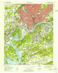
1953 Map of Knoxville
USGS Topo · Published 1955About this map
The Tennessee River snakes through the heart of this mid-century urban landscape, where the rising waters of Fort Loudoun Lake meet a thriving rail and educational hub. The Southern Railway and the Coster Yards dominate the northern corridor, serving a city defined by established institutions like the University of Tennessee and Knoxville College. Residential patterns are clearly etched into the terrain, from the historic plots of Old Gray Cemetery to the post-war expansion in Middlebrook Heights and Lake Forest.
Find a feature on this map
150 named features on this map. Tap any name to fly to it.
Don’t see what you’re looking for? This feature index may not catch every label — zoom into the map to look around manually.
Map Details
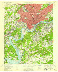
Editions of this 1953 Knoxville Map
2 editions found
Other maps of this area

1886 · Knoxville
USGS Topo · 1:125,000

1892 · Knoxville
USGS Topo · 1:125,000

1893 · Briceville
USGS Topo · 1:125,000

1894 · Knoxville
USGS Topo · 1:125,000

1895 · Loudon
USGS Topo · 1:125,000

1895 · Briceville
USGS Topo · 1:125,000

1895 · Knoxville
USGS Topo · 1:125,000

1896 · Briceville
USGS Topo · 1:125,000

1897 · Maynardville
USGS Topo · 1:125,000

1900 · Maynardville
USGS Topo · 1:125,000