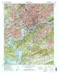
1978 Map of Knoxville
USGS Topo · Published 1979About this map
Fort Loudoun Lake and the Tennessee River anchor this late-1970s view of Tennessee’s urban heart, where the water bends around Looney Islands and Lyons Island. The map documents the city’s post-war suburban and industrial footprint, from the sprawling Coster Yards in the north to the established neighborhoods of Sequoyah Hills and Island Home. Educational and civic infrastructure is densely plotted, including Fulton High Sch, Austin High Sch, and the Naval Reserve Armory.
Find a feature on this map
84 named features on this map. Tap any name to fly to it.
Don’t see what you’re looking for? This feature index may not catch every label — zoom into the map to look around manually.
Map Details
Editions of this 1978 Knoxville Map
2 editions found
Other maps of this area

1886 · Knoxville
USGS Topo · 1:125,000

1892 · Knoxville
USGS Topo · 1:125,000

1893 · Briceville
USGS Topo · 1:125,000

1894 · Knoxville
USGS Topo · 1:125,000

1895 · Loudon
USGS Topo · 1:125,000

1895 · Briceville
USGS Topo · 1:125,000

1895 · Knoxville
USGS Topo · 1:125,000

1896 · Briceville
USGS Topo · 1:125,000

1897 · Maynardville
USGS Topo · 1:125,000

1900 · Maynardville
USGS Topo · 1:125,000