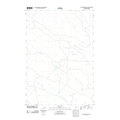
2011 Map of Knudson Draw NE
USGS Topo · Published 2011About this map
Dry Creek and Hay Creek dominate the drainage patterns of this corner of Carter County, shaping a landscape defined by seasonal watercourses and remote rangeland. The map illustrates a high-plains environment where water is the primary architect of the terrain, carving out the namesake draws and coulees typical of Southeastern Montana. The confluence of several tributaries, including the North Fork, Middle Fork, and South Fork Whitetail Creek, demonstrates a complex hydrological network that sustains the local cattle ranching economy. This early 21st-century survey reveals a sparse network of local roads and 4WD tracks that follow the natural contours of the land, connecting isolated points across the open prairie. Further north, the presence of Timber Creek, Cady Creek, and Muskrat Creek suggests a transition into the more broken country found near the Montana-North Dakota border.
Find a feature on this map
8 named features on this map. Tap any name to fly to it.
Don’t see what you’re looking for? This feature index may not catch every label — zoom into the map to look around manually.
Map Details
Editions of this 2011 Knudson Draw NE Map
This is the sole edition of this map. No revisions or reprints were ever made.
Other maps of this area

1954 · Ekalaka
USGS Topo · 1:250,000

1956 · Ekalaka
USGS Topo · 1:250,000

1958 · Ekalaka
USGS Topo · 1:250,000

1965 · Ekalaka
USGS Topo · 1:250,000

1979 · W L Butte
USGS Topo · 1:24,000

1979 · Dutchman Creek
USGS Topo · 1:24,000
1979 · Pocochichee Butte
USGS Topo · 1:24,000

1981 · Alzada
USGS Topo · 1:100,000
1982 · Whitetail Creek
USGS Topo · 1:24,000

1982 · Phillippi Reservoir
USGS Topo · 1:24,000