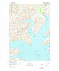
1952 Map of Kodiak A-5
USGS Topo · Published 1974About this map
Kodiak Island is home to the early Russian-era settlement site at Three Saints Bay, which remains a prominent maritime feature in this 1950s-era topographic study. The map documents a landscape defined by deep fjords and narrow passages, such as Sitkalidak Strait separating the main island from Sitkalidak Island. The label for Nunamiut (Aband) serves as a significant genealogical marker, indicating a former settlement on the western shore of the bay. The intricate coastline is dotted with smaller inlets like Barling Bay and Newman Bay, while hazardous waters are noted at Tallapoosa Shoal. This era of mapping was conducted via photogrammetry, capturing the shoreline of the Kodiak National Wildlife Refuge before modern development altered the remote maritime character of the borough.
Find a feature on this map
20 named features on this map. Tap any name to fly to it.
Don’t see what you’re looking for? This feature index may not catch every label — zoom into the map to look around manually.
Map Details
Editions of this 1952 Kodiak A-5 Map
This is the sole edition of this map. No revisions or reprints were ever made.
Other maps of this area

1951 · Kaguyak
USGS Topo · 1:250,000

1952 · Kodiak
USGS Topo · 1:250,000

1952 · Kaguyak
USGS Topo · 1:250,000

1952 · Kodiak B-6
USGS Topo · 1:63,360

1952 · Kaguyak D-5
USGS Topo · 1:63,360

1952 · Kodiak B-5
USGS Topo · 1:63,360

1952 · Kaguyak D-6
USGS Topo · 1:63,360

1952 · Kodiak B-4
USGS Topo · 1:63,360

1952 · Kodiak A-6
USGS Topo · 1:63,360
1952 · Kodiak A-4
USGS Topo · 1:63,360