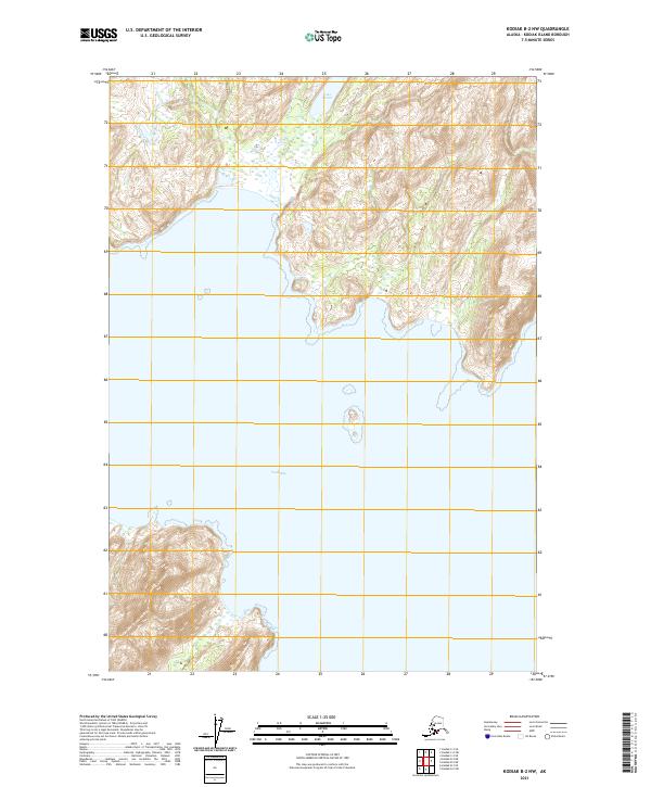
2021 Map of Kodiak B-2 NW
USGS Topo · Published 2021About this map
Ugak Bay dominates this coastal survey, where the saltwater of the North Pacific meets the steep, island-bound terrain of Kodiak Island. The shoreline here is deeply indented, defined by narrow coves and dramatic elevation changes that rise abruptly from the water's edge. Inland, the freshwater Lake Miam is positioned among the high ridges, illustrating the complex drainage patterns common to this maritime environment. This document, produced by the U.S. Geological Survey, maps a landscape largely untouched by permanent road infrastructure or industrial development. Instead, it reveals the raw topography of the borough, focusing on the natural contours and hydrologic features that dictate travel and survival in this corner of Alaska. The map serves as a primary record of the coastal and interior landforms as they existed in the early 2020s, providing a baseline for researchers tracking geological or ecological changes in the region.
Find a feature on this map
6 named features on this map. Tap any name to fly to it.
Don’t see what you’re looking for? This feature index may not catch every label — zoom into the map to look around manually.
Map Details
Editions of this 2021 Kodiak B-2 NW Map
This is the sole edition of this map. No revisions or reprints were ever made.
Other maps of this area

1949 · Kodiak C-2
USGS Topo · 1:63,360

1949 · Kodiak B-1 and B-2
USGS Topo · 1:63,360

1949 · Kodiak B-3
USGS Topo · 1:63,360

1950 · Kodiak B-3
USGS Topo · 1:63,360

1951 · Kodiak B-1 and B-2
USGS Topo · 1:63,360

1952 · Kodiak
USGS Topo · 1:250,000

1952 · Kodiak C-3
USGS Topo · 1:63,360

1954 · Kodiak C-3
USGS Topo · 1:63,360
1987 · Kodiak B-2 NE
USGS Topo · 1:25,000
1987 · Kodiak C-2 SE
USGS Topo · 1:25,000