
1949 Map of Kodiak C-1
USGS Topo · Published 1964About this map
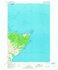
Kodiak Island meets the restless waters of the Gulf of Alaska in this mid-century survey, revealing a landscape defined by sharp coastal points and high peaks. The northeastern peninsula is anchored by the Miller Airstrip, a critical node for early aviation in the territory during the 1940s. The coastline is heavily indented with features like Chiniak Bay and Isthmus Bay, while landmarks such as Cape Chiniak and Cape Greville mark the transition toward the open Pacific Ocean. Inland, the terrain rises sharply to summits including Boyer Peak and Twin Peaks, illustrating the island's steep topography. Navigational hazards and offshore features are meticulously noted, from the isolated Humpback Rock to the clusters of Long Island and Refuge Island in the north, providing a comprehensive view of the maritime and terrestrial interface before modern development.
Find a feature on this map
29 named features on this map. Tap any name to fly to it.
Don’t see what you’re looking for? This feature index may not catch every label — zoom into the map to look around manually.
Map Details
Editions of this 1949 Kodiak C-1 Map
3 editions found
Other maps of this area

1949 · Kodiak C-2
USGS Topo · 1:63,360

1949 · Kodiak B-1 and B-2
USGS Topo · 1:63,360

1949 · Kodiak D-2
USGS Topo · 1:63,360

1949 · Kodiak D-1
USGS Topo · 1:63,360

1951 · Kodiak D-1
USGS Topo · 1:63,360

1951 · Kodiak B-1 and B-2
USGS Topo · 1:63,360

1951 · Kodiak D-2
USGS Topo · 1:63,360

1951 · Kodiak C-1
USGS Topo · 1:63,360

1952 · Kodiak
USGS Topo · 1:250,000
1987 · Kodiak C-1 SW
USGS Topo · 1:25,000