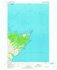
1949 Map of Kodiak C-1
USGS Topo · Published 1967About this map
Kodiak Island is defined here by the extensive US Naval Reservation occupying the Chiniak peninsula during the mid-century era. This strategic coastal landscape, surveyed shortly after the war, shows a network of roads and trails connecting Miller Field to the rugged points of the shoreline. The transition from the sheltered waters of Chiniak Bay to the open Gulf of Alaska is marked by prominent maritime landmarks like Cape Chiniak and Cape Greville.
Find a feature on this map
31 named features on this map. Tap any name to fly to it.
Don’t see what you’re looking for? This feature index may not catch every label — zoom into the map to look around manually.
Map Details
Editions of this 1949 Kodiak C-1 Map
3 editions found
Other maps of this area

1949 · Kodiak C-2
USGS Topo · 1:63,360

1949 · Kodiak B-1 and B-2
USGS Topo · 1:63,360

1949 · Kodiak D-2
USGS Topo · 1:63,360

1949 · Kodiak C-1
USGS Topo · 1:63,360

1949 · Kodiak D-1
USGS Topo · 1:63,360

1951 · Kodiak D-1
USGS Topo · 1:63,360

1951 · Kodiak B-1 and B-2
USGS Topo · 1:63,360

1951 · Kodiak D-2
USGS Topo · 1:63,360

1951 · Kodiak C-1
USGS Topo · 1:63,360

1952 · Kodiak
USGS Topo · 1:250,000