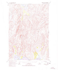
1952 Map of Kodiak C-3
USGS Topo · Published 1973About this map
Kodiak National Wildlife Refuge dominates the western portion of this mid-century topographic survey, revealing a landscape defined by high peaks and complex glacial drainages. The topography is anchored by the prominent summits of Crown Mountain and Center Mountain, with steep ridgelines falling away toward the indented coastlines of Kizhuyak Bay to the north and Ugak Bay to the south.
Find a feature on this map
15 named features on this map. Tap any name to fly to it.
Don’t see what you’re looking for? This feature index may not catch every label — zoom into the map to look around manually.
Map Details
Editions of this 1952 Kodiak C-3 Map
3 editions found

Other maps of this area

1947 · Kodiak D-3
USGS Topo · 1:63,360

1949 · Kodiak C-2
USGS Topo · 1:63,360

1949 · Kodiak B-1 and B-2
USGS Topo · 1:63,360

1949 · Kodiak D-2
USGS Topo · 1:63,360

1949 · Kodiak D-3
USGS Topo · 1:63,360

1949 · Kodiak B-3
USGS Topo · 1:63,360

1950 · Kodiak B-3
USGS Topo · 1:63,360

1950 · Kodiak D-3
USGS Topo · 1:63,360

1951 · Kodiak B-1 and B-2
USGS Topo · 1:63,360

1951 · Kodiak D-2
USGS Topo · 1:63,360