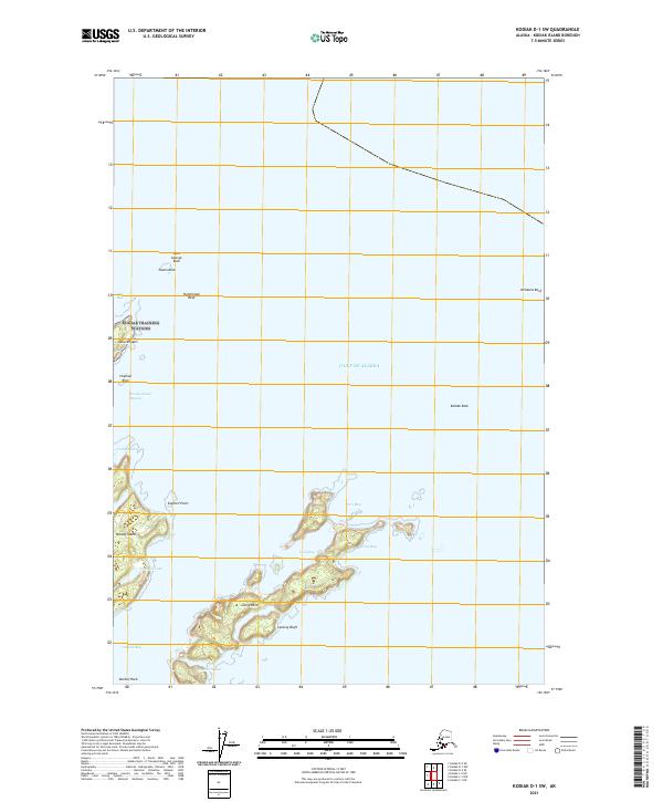
2021 Map of Kodiak D-1 SW
USGS Topo · Published 2021About this map
Woody Island and Long Island dominate this coastal survey of the Chiniak Bay area, providing a detailed look at the maritime geography of the Gulf of Alaska as it appeared in 2021. The landscape is defined by its broken shoreline and numerous navigational hazards, from the prominent Spruce Cape in the northwest to outlying features like Saint George Rock and Williams Reef. Internal hydrology on the islands is sparse but notable, including Elephant Lake and Southern Lake.
Find a feature on this map
27 named features on this map. Tap any name to fly to it.
Don’t see what you’re looking for? This feature index may not catch every label — zoom into the map to look around manually.
Map Details
Editions of this 2021 Kodiak D-1 SW Map
This is the sole edition of this map. No revisions or reprints were ever made.
Other maps of this area

1949 · Kodiak C-2
USGS Topo · 1:63,360

1949 · Kodiak D-2
USGS Topo · 1:63,360

1949 · Kodiak C-1
USGS Topo · 1:63,360

1949 · Kodiak D-1
USGS Topo · 1:63,360

1951 · Kodiak D-1
USGS Topo · 1:63,360

1951 · Kodiak D-2
USGS Topo · 1:63,360

1951 · Kodiak C-1
USGS Topo · 1:63,360

1952 · Kodiak
USGS Topo · 1:250,000
1987 · Kodiak D-1 SW
USGS Topo · 1:25,000
1987 · Kodiak C-2 NE
USGS Topo · 1:25,000