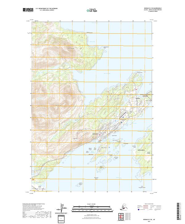
2021 Map of Kodiak D-2 SE
USGS Topo · Published 2021About this map
Kodiak serves as the focal point of this coastal survey, where the city's complex shoreline meets the high elevations of Pillar Mtn and the Devils Prongs. The landscape is defined by its maritime infrastructure, including Saint Herman Harbor, the Inner Harbor, and the Kodiak Municipal Airport. Residential and civic growth is evident in the dense street grid near the Kodiak Courthouse and the presence of Kodiak College overlooking Shahafka Cove.
Find a feature on this map
147 named features on this map. Tap any name to fly to it.
Don’t see what you’re looking for? This feature index may not catch every label — zoom into the map to look around manually.
Map Details
Editions of this 2021 Kodiak D-2 SE Map
This is the sole edition of this map. No revisions or reprints were ever made.
Other maps of this area

1949 · Kodiak C-2
USGS Topo · 1:63,360

1949 · Kodiak D-2
USGS Topo · 1:63,360

1949 · Kodiak C-1
USGS Topo · 1:63,360

1949 · Kodiak D-1
USGS Topo · 1:63,360

1951 · Kodiak D-1
USGS Topo · 1:63,360

1951 · Kodiak D-2
USGS Topo · 1:63,360

1951 · Kodiak C-1
USGS Topo · 1:63,360

1952 · Kodiak
USGS Topo · 1:250,000
1987 · Kodiak D-1 SW
USGS Topo · 1:25,000
1987 · Kodiak C-2 NW
USGS Topo · 1:25,000