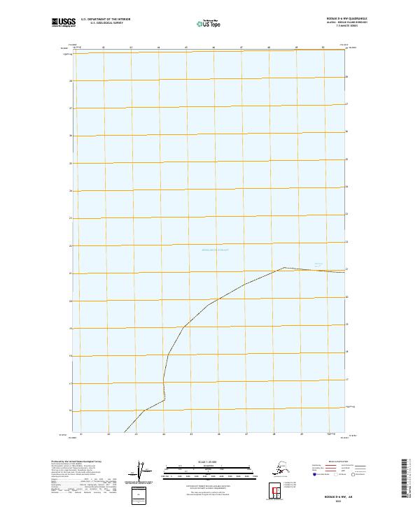
2021 Map of Kodiak D-6 NW
USGS Topo · Published 2021About this map
Shelikof Strait dominates this 2021 maritime and coastal survey of the western reaches of Kodiak Island. The map focuses almost entirely on the open waters of the strait, serving as a modern snapshot of the vital passage that separates the island from the Alaska Peninsula. While the majority of the area is maritime, the eastern edge reveals the land divisions of t26s r28w, showing the formal cadastral framework that overlies this remote coastal landscape. This specific survey is notable for its focus on the hydrographic boundary and the intersection of maritime territory with the Public Land Survey System, providing a clear record of administrative and geographical boundaries in the Gulf of Alaska region.
Find a feature on this map
21 named features on this map. Tap any name to fly to it.
Don’t see what you’re looking for? This feature index may not catch every label — zoom into the map to look around manually.
Map Details
Editions of this 2021 Kodiak D-6 NW Map
This is the sole edition of this map. No revisions or reprints were ever made.
Other maps of this area

1948 · Mt Katmai
USGS Topo · 1:250,000

1951 · Mt Katmai
USGS Topo · 1:250,000

1951 · Karluk
USGS Topo · 1:250,000
1951 · Mount Katmai A-1
USGS Topo · 1:63,360

1951 · Kodiak D-6
USGS Topo · 1:63,360

1952 · Kodiak
USGS Topo · 1:250,000

1952 · Afognak
USGS Topo · 1:250,000

1952 · Karluk
USGS Topo · 1:250,000
1954 · Kodiak D-6
USGS Topo · 1:63,360

1964 · Mt. Katmai
USGS Topo · 1:250,000