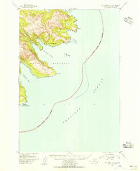
1951 Map of Mount Katmai A-1
USGS Topo · Published 1956About this map
Katmai National Monument dominates this coastal landscape on the edge of the Shelikof Strait, where deep-water inlets meet the high, glaciated terrain of the Alaska Peninsula. Compiled from 1951 aerial photography, the map reveals a rugged shoreline defined by dramatic protrusions like Cape Gull and Cape Kuliak. The inland topography rises sharply from the sea, showing the intricate contour work of the Geological Survey. Large Tidal Flats are visible at the heads of Kaflia Bay and Kuliak Bay, indicating the dynamic intertidal environment and potential hazards for mariners. The southern portion of the sheet features the settlement or landmark of Atushagvik near Cape Atushagvik, while the National Monument Boundary carves through the strait, marking the formal limit of protected lands in this remote maritime wilderness.
Find a feature on this map
13 named features on this map. Tap any name to fly to it.
Don’t see what you’re looking for? This feature index may not catch every label — zoom into the map to look around manually.
Map Details
Editions of this 1951 Mount Katmai A-1 Map
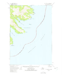
2 editions found
Other maps of this area

1948 · Mt Katmai
USGS Topo · 1:250,000

1951 · Mt Katmai
USGS Topo · 1:250,000

1951 · Karluk
USGS Topo · 1:250,000

1951 · Mount Katmai A-2
USGS Topo · 1:63,360

1951 · Mount Katmai B-1
USGS Topo · 1:63,360

1951 · Mount Katmai B-2
USGS Topo · 1:63,360

1951 · Kodiak D-6
USGS Topo · 1:63,360

1952 · Kodiak
USGS Topo · 1:250,000

1952 · Afognak
USGS Topo · 1:250,000

1952 · Karluk
USGS Topo · 1:250,000