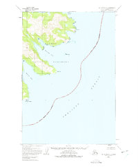
1951 Map of Mount Katmai A-1
USGS Topo · Published 1975About this map
Katmai National Monument dominates this coastal landscape as it appeared in the mid-20th century, defined by a series of deep glacial fjords opening into the Shelikof Strait. The intricate coastline is punctuated by prominent headlands like Cape Gull and Cape Kuliak, protecting secluded waters such as Kaflia Bay and Kuliak Bay.
Find a feature on this map
13 named features on this map. Tap any name to fly to it.
Don’t see what you’re looking for? This feature index may not catch every label — zoom into the map to look around manually.
Map Details
Editions of this 1951 Mount Katmai A-1 Map
2 editions found
Other maps of this area

1948 · Mt Katmai
USGS Topo · 1:250,000

1951 · Mt Katmai
USGS Topo · 1:250,000

1951 · Karluk
USGS Topo · 1:250,000

1951 · Mount Katmai A-2
USGS Topo · 1:63,360
1951 · Mount Katmai A-1
USGS Topo · 1:63,360

1951 · Mount Katmai B-1
USGS Topo · 1:63,360

1951 · Mount Katmai B-2
USGS Topo · 1:63,360

1951 · Kodiak D-6
USGS Topo · 1:63,360

1952 · Kodiak
USGS Topo · 1:250,000

1952 · Afognak
USGS Topo · 1:250,000