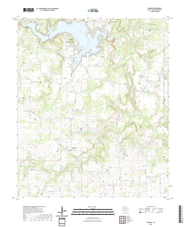
2022 Map of Kokomo
USGS Topo · Published 2022About this map
Staff and Kokomo anchor this rural landscape in Eastland County, where the terrain is defined by the winding course of the Leon River and the significant reach of Lake Leon. The area's settlement history is clearly visible through a high density of rural burial grounds, including the Kokomo Cem, Staff Cem, and Gregg Cem, along with family-named sites like the Simpson Cem and Bollinger Cem. These locations often signal the sites of former community hubs or homesteads that may no longer be prominent on the modern landscape.
Find a feature on this map
77 named features on this map. Tap any name to fly to it.
Don’t see what you’re looking for? This feature index may not catch every label — zoom into the map to look around manually.
Map Details
Editions of this 2022 Kokomo Map
This is the sole edition of this map. No revisions or reprints were ever made.
Other maps of this area

1894 · Eastland
USGS Topo · 1:125,000

1954 · Abilene
USGS Topo · 1:250,000

1958 · Abilene
USGS Topo · 1:250,000

1966 · Kokomo
USGS Topo · 1:24,000
1966 · Desdemona
USGS Topo · 1:24,000

1966 · Carbon
USGS Topo · 1:24,000
1966 · Bear Mountain
USGS Topo · 1:24,000

1966 · Eastland
USGS Topo · 1:24,000

1966 · Ranger
USGS Topo · 1:24,000
1968 · Rucker
USGS Topo · 1:24,000