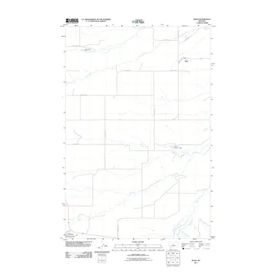
2011 Map of Kolin
USGS Topo · Published 2011About this map
Hobson stands as the primary hub in this Judith Basin County landscape, anchoring the southwest corner near the intersection of Central Ave and the railroad. The Hobson Post Office serves the local ranching community, while the smaller settlement of Kolin is situated to the northeast along Railway Ave. The terrain is defined by a dendritic network of watercourses, most notably the winding Judith River and its tributaries including Ross Fork Creek and Dawkins Branch. Agricultural water management is evident through features such as the Indian Judy Dam on Louse Creek and the Cecrle Number 1 Dam. The grid of county roads, such as County Rd-311 and County Rd-308, illustrates the organized parceling of this central Montana prairie for dryland farming and livestock operations.
Find a feature on this map
21 named features on this map. Tap any name to fly to it.
Don’t see what you’re looking for? This feature index may not catch every label — zoom into the map to look around manually.
Map Details
Editions of this 2011 Kolin Map
This is the sole edition of this map. No revisions or reprints were ever made.
Other maps of this area

1889 · Big Snowy Mountain
USGS Topo · 1:250,000

1893 · Big Snowy Mountain
USGS Topo · 1:250,000

1954 · Roundup
USGS Topo · 1:250,000

1954 · Lewistown
USGS Topo · 1:250,000

1958 · Roundup
USGS Topo · 1:250,000

1959 · Lewistown
USGS Topo · 1:250,000

1970 · Harwood Bench
USGS Topo · 1:24,000

1970 · Danvers
USGS Topo · 1:24,000

1970 · Moore
USGS Topo · 1:24,000
1970 · Moccasin
USGS Topo · 1:24,000