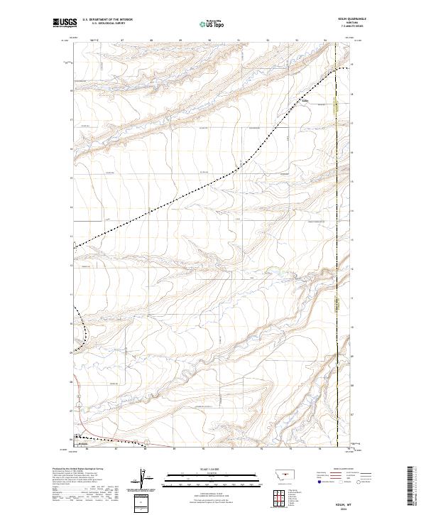
2024 Map of Kolin
USGS Topo · Published 2024About this map
Hobson and the settlement of Kolin anchor this contemporary survey of the central Montana plains, where the Judith River cuts through the southwest corner of the quadrangle. The landscape is defined by its drainage systems and a rectilinear grid of county roads that speak to the region's enduring agricultural layout. Waterways such as Louise Creek and Ross Fork Creek carve deep, winding paths across the terrain, contrasting with the rigid geometry of Sun Basin Rd and Stockfarm Rd. The boundary between Judith Basin and Fergus Counties runs along the eastern edge, marking a jurisdictional divide in an otherwise contiguous expanse of ranching and farming land. Notable local transit corridors like S-426 and Pioneer Rd connect isolated homesteads to the primary settlements, reflecting the sparse but organized habitation of this high plains environment.
Find a feature on this map
32 named features on this map. Tap any name to fly to it.
Don’t see what you’re looking for? This feature index may not catch every label — zoom into the map to look around manually.
Map Details
Editions of this 2024 Kolin Map
This is the sole edition of this map. No revisions or reprints were ever made.
Other maps of this area

1889 · Big Snowy Mountain
USGS Topo · 1:250,000

1893 · Big Snowy Mountain
USGS Topo · 1:250,000

1954 · Roundup
USGS Topo · 1:250,000

1954 · Lewistown
USGS Topo · 1:250,000

1958 · Roundup
USGS Topo · 1:250,000

1959 · Lewistown
USGS Topo · 1:250,000

1970 · Harwood Bench
USGS Topo · 1:24,000

1970 · Danvers
USGS Topo · 1:24,000

1970 · Moore
USGS Topo · 1:24,000
1970 · Moccasin
USGS Topo · 1:24,000