Loading...
Loading map...2024 Map of Koloa
USGS Topo · Published 2024About this map
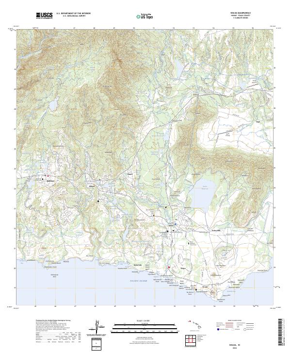
Kōloa Mill and the surrounding agricultural infrastructure define the landscape of south Kauai, where a sophisticated network of water management features like Waita Reservoir and Aepo Reservoir supported the local economy. The map details the transition from the upland reaches of Kanaele Swamp and the slopes of Omoe down to the coastal developments of Po‘ipū and Kukui‘ula.
Find a feature on this map
164 named features on this map. Tap any name to fly to it.
Don’t see what you’re looking for? This feature index may not catch every label — zoom into the map to look around manually.
Map Details
Date Portrayed2024
Date Published2024
PublisherU.S. Geological Survey
Map TypeTopographic
Scale1:24000
Physical Dimensions24 x 29 inches
Editions of this 2024 Koloa Map
This is the sole edition of this map. No revisions or reprints were ever made.
Historical Maps of Kalaheo Through Time
4 maps found

Featured Locations
Source Details
SourceU.S. Geological Survey
CopyrightPublic Domain