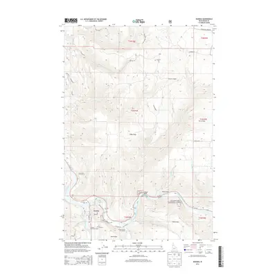
2014 Map of Kooskia
USGS Topo · Published 2014About this map
The Middle Fork Clearwater River and South Fork Clearwater River converge at Kooskia, a river-valley settlement defined by its position at the gateway to the Clearwater National Forest. The local topography is dominated by dramatic elevation changes rising from the riverbanks to high points like Kidder Ridge and Tahoe Ridge. Notable landmarks near the town include the Kooskia National Fish Hatchery and Kooskia Municipal Airport, while the smaller community of Kidder sits further north near Church Canyon. Local history is preserved in several burial grounds, including Nicodemus Cem, Miller Cem, and Pine Grove Cem. Steep transit routes like Adams Grade and Winona Grade Rd illustrate the challenging terrain that surrounds the Clearwater valley.
Find a feature on this map
54 named features on this map. Tap any name to fly to it.
Don’t see what you’re looking for? This feature index may not catch every label — zoom into the map to look around manually.
Map Details
Editions of this 2014 Kooskia Map
This is the sole edition of this map. No revisions or reprints were ever made.
Other maps of this area

1924 · Kamiah
USGS Topo · 1:125,000

1924 · Weippe
USGS Topo · 1:125,000

1955 · Pullman
USGS Topo · 1:250,000

1956 · Hamilton
USGS Topo · 1:250,000

1958 · Pullman
USGS Topo · 1:250,000

1959 · Hamilton
USGS Topo · 1:250,000

1960 · Hamilton
USGS Topo · 1:250,000

1964 · Hamilton
USGS Topo · 1:250,000

1966 · Kooskia
USGS Topo · 1:24,000
1966 · Stites
USGS Topo · 1:24,000