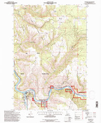
1994 Map of Kooskia
USGS Topo · Published 1997About this map
The confluence of the Middle Fork Clearwater River and the South Fork anchors this Idaho landscape within the Nez Perce Indian Reservation. The town of Kooskia serves as a local hub, situated near historical infrastructure like the Lochsa Ranger Station and the Kooskia National Fish Hatchery. The settlement pattern follows the river valleys and high ridges, including Kidder Ridge and Harris Ridge, which rise steeply from the water's edge. Genealogists will find several burial grounds documented, such as Grandview Cem near the Kidder townsite and Nicodemus Cem closer to the river. The terrain is marked by distinctive local landmarks like Penny Cliffs and Maggie Bend, reflecting a landscape deeply tied to its river-driven geography and the administrative boundaries of the national forest and reservation.
Find a feature on this map
34 named features on this map. Tap any name to fly to it.
Don’t see what you’re looking for? This feature index may not catch every label — zoom into the map to look around manually.
Map Details
Editions of this 1994 Kooskia Map
This is the sole edition of this map. No revisions or reprints were ever made.
Other maps of this area

1924 · Kamiah
USGS Topo · 1:125,000

1924 · Weippe
USGS Topo · 1:125,000

1955 · Pullman
USGS Topo · 1:250,000

1956 · Hamilton
USGS Topo · 1:250,000

1958 · Pullman
USGS Topo · 1:250,000

1959 · Hamilton
USGS Topo · 1:250,000

1960 · Hamilton
USGS Topo · 1:250,000

1964 · Hamilton
USGS Topo · 1:250,000

1966 · Kooskia
USGS Topo · 1:24,000
1966 · Stites
USGS Topo · 1:24,000