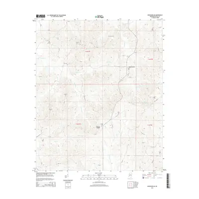
2015 Map of Kosciusko NE
USGS Topo · Published 2015About this map
Pierces Chapel and New Salem anchor this rural landscape in Attala County, defined by a dense network of country cemeteries and small watercourses. The topography is shaped by the drainage of Scoobachita Creek and Sugar Creek, which feed into the larger river systems of central Mississippi. This area maintains a strong connection to its pioneer and family roots, evidenced by the numerous burial grounds scattered across the terrain, including Smyrna Cemetery and Oak Ridge Cemetery.
Find a feature on this map
62 named features on this map. Tap any name to fly to it.
Don’t see what you’re looking for? This feature index may not catch every label — zoom into the map to look around manually.
Map Details
Editions of this 2015 Kosciusko NE Map
This is the sole edition of this map. No revisions or reprints were ever made.
Other maps of this area

1953 · West Point
USGS Topo · 1:250,000

1958 · West Point
USGS Topo · 1:250,000

1963 · West Point
USGS Topo · 1:250,000

1964 · Kosciusko NE
USGS Topo · 1:24,000

1964 · Hesterville
USGS Topo · 1:24,000

1964 · Kosciusko
USGS Topo · 1:24,000
1964 · McAdams
USGS Topo · 1:24,000

1966 · Poplar Creek
USGS Topo · 1:24,000

1966 · Kosciusko
USGS Topo · 1:62,500

1966 · French Camp
USGS Topo · 1:24,000