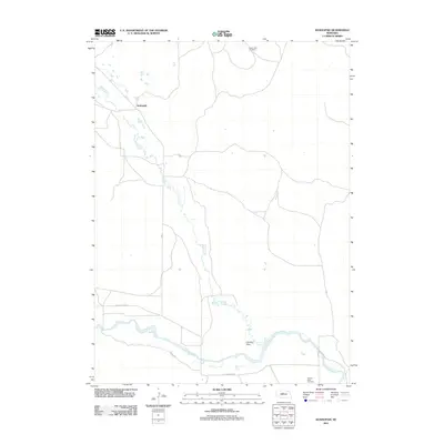
2011 Map of Koshopah
USGS Topo · Published 2011About this map
Goose Creek meanders southward through this rural Nebraska landscape, eventually joining the wider North Loup River in the southern portion of the quadrangle. This area of Brown County is characterized by sparsely populated rangeland and the braided channels typical of the Sandhills region. The settlement of Koshopah is located in the northwest, serving as a focal point in a territory defined by expansive open spaces and a network of county roads. Local genealogy and history are preserved at small burial sites such as Valley View Cemetery in the north and Hawley Flats Cemetery near the river. These markers, along with the landing at Hawley Flats, indicate the legacy of early ranching and river-based settlement patterns that have persisted into the twenty-first century.
Find a feature on this map
10 named features on this map. Tap any name to fly to it.
Don’t see what you’re looking for? This feature index may not catch every label — zoom into the map to look around manually.
Map Details
Editions of this 2011 Koshopah Map
This is the sole edition of this map. No revisions or reprints were ever made.
Other maps of this area

1949 · Koshopah
USGS Topo · 1:62,500

1951 · Dunning
USGS Topo · 1:62,500

1951 · Koshopah
USGS Topo · 1:62,500

1952 · Brewster NW
USGS Topo · 1:24,000

1954 · North Platte
USGS Topo · 1:250,000

1955 · Broken Bow
USGS Topo · 1:250,000

1955 · O'Neill
USGS Topo · 1:250,000

1956 · Broken Bow
USGS Topo · 1:250,000

1956 · North Platte
USGS Topo · 1:250,000

1957 · North Platte
USGS Topo · 1:250,000