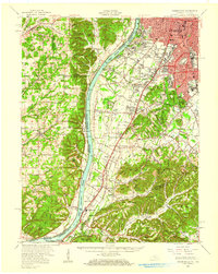
1950 Map of Kosmosdale
USGS Topo · Published 1959About this map
Louisville and its southwestern expansion dominate the landscape in the years following World War II, showing a mix of established urban neighborhoods like South Parkland and Wilder Park alongside industrial landmarks. The legendary Churchill Downs and the sprawling U S Naval Ordnance Plant underscore the city's sporting and industrial significance, while Iroquois Park provides a large green space at the city's edge.
Find a feature on this map
188 named features on this map. Tap any name to fly to it.
Don’t see what you’re looking for? This feature index may not catch every label — zoom into the map to look around manually.
Map Details
Editions of this 1950 Kosmosdale Map
This is the sole edition of this map. No revisions or reprints were ever made.
Other maps of this area

1905 · Prospect
USGS Topo · 1:62,500

1907 · Louisville
USGS Topo · 1:62,500

1909 · Kosmosdale
USGS Topo · 1:48,000

1912 · Prospect
USGS Topo · 1:62,500

1912 · Kosmosdale
USGS Topo · 1:62,500

1931 · Corydon
USGS Topo · 1:62,500

1936 · Vine Grove
USGS Topo · 1:62,500

1937 · Jeffersonville
USGS Topo · 1:24,000

1939 · New Albany
USGS Topo · 1:24,000

1939 · Georgetown
USGS Topo · 1:24,000